

Miyar in the Lahaul Valley
Disrict Lahaul-Spiti, Himachal Pradesh India
Type of Proposed Protection:
National Conservation Reserve
Conservation Partners:
Himachal Pradesh Forest Department, International Big Cat Alliance, Wildlife Institute of India, Snow Leopard Conservation Society
Ecoregion:
Himalayan Subtropical Pine Forests
Scale of the Proposed Protected Area:
56,200 Hectares - 138,873 Acres
Total Declaration Cost, including protected area management and trail support:
$655,000

The Miyar region of Himachal Pradesh, Spiti Valley, India. Photograph by Timothy A. Gonsalves.

A rare snow leopard (Panthera uncia) in the Spiti, the state animal. Photograph by Snow Leopard Trust, India, a conservation partner.

Chukar Partridge (Alectoris chukar) is a widespread resident in western Himalayas of India, found upto an altitude of 5000 m. Size: 38 cm. Chukar Partridge was earlier considered to be conspecific with Rock Partridge (Alectoris graeca), but is now considered a distinct species. There are fourteen geographical subspecies that range from Turkey and Mediterranean islands in the west to India and central Nepal in the east. Chukar has also been successfully introduced, as a game bird into western North America, the Hawaiian Islands, England and New Zealand. Photograph by Reurinkjan.
Himachal Pradesh, in the Indian Himalayan Region, is one of the richest reservoirs of biological diversity in the world: around 463 bird species, 77 mammalian, 44 reptile and 80 fish species. It also has a high diversity of medicinal and aromatic plants.
The state bird of Himachal Pradesh is the Western tragopan, locally known as the jujurana. It is one of the rarest living pheasants in the world. Himachal Pradesh has currently five National Parks, 30 wildlife sanctuaries and 3 conservation reserves.

A rare Musk deer in the Lahul-Spiti Valley. Photograph by Inderjeet of Rashel village.
Historic Communites:
Tribal community lands, about 3,000 people call this area home
Conservation Partners:
Himachal Pradesh Forest Department, International Big Cat Alliance, Wildlife Institute of India, Snow Leopard Conservation Society
Home to Rare Species:
Snow leopard (Panthera uncia), Himalayan Brown Bear (Ursus arctos), Himalayan Musk Deer (Moschus leucogaster), Himalayan Tahr (Hemitragus jemlahicus), Himalayan ibex (Capra siberica), Himalayan Monal (Lophophorus impejanus), Western Tragopan (Tragopan melanocephalus), Bitter-Root (Aconitum violaceum), and the Himalayan Marsh Orchid (Dactylorhiza hatagirea).
Grant Research, Care and Diligence Team:
Priyanka Justa, Wildlife Institute of India, Dr. Salvador Lyngdoh, Wildlife Institute of India, Dr. Andy Lee, Resolve, Dr. Eric Dinerstein, Conservation X Labs, Dr. Haley Mellin, Conserve
Conservation Imperatives Rarity?:
Yes

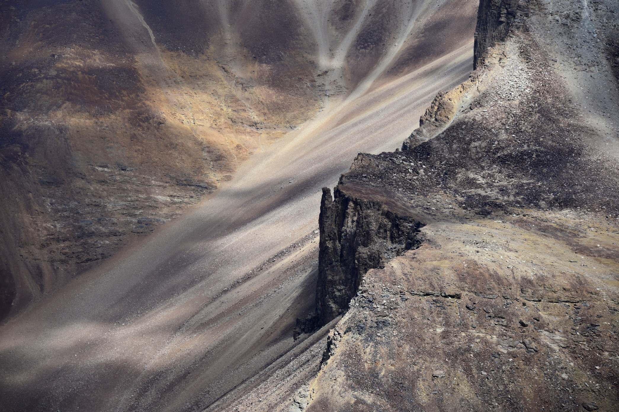
A waterfall in Northern Spiti, India.
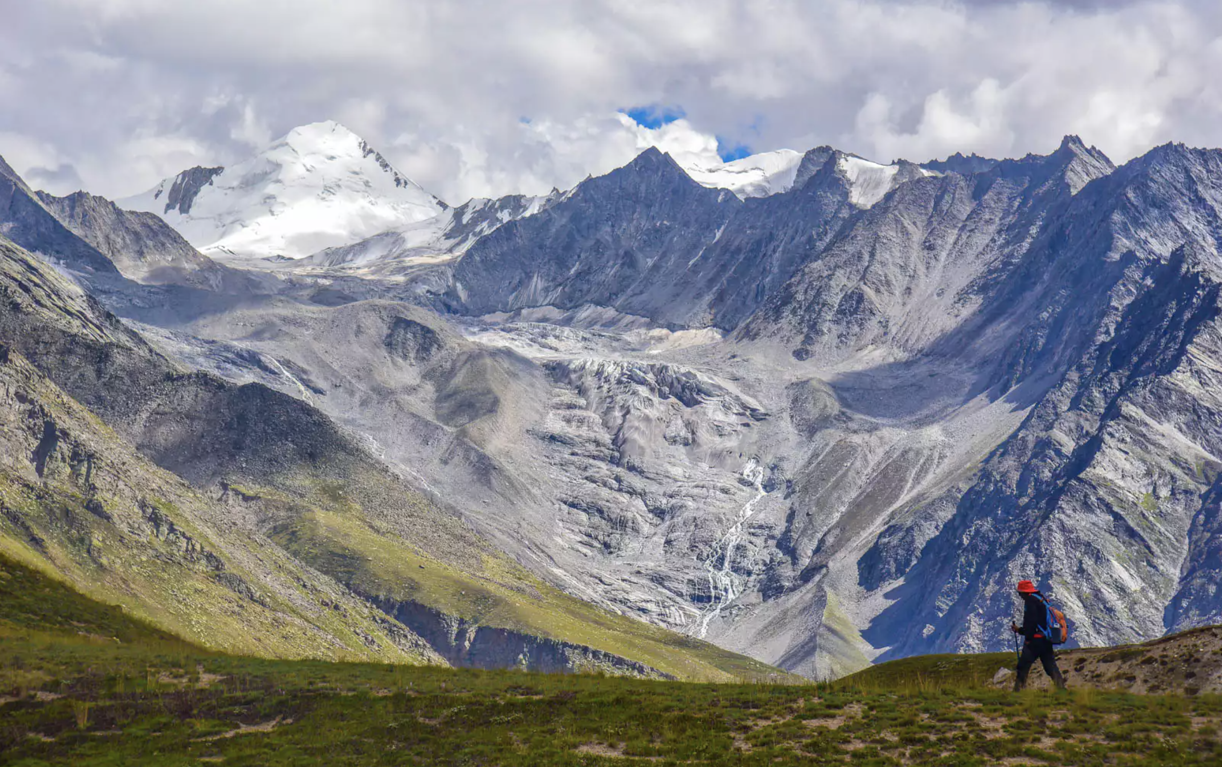
The vastness of Miyar, India.
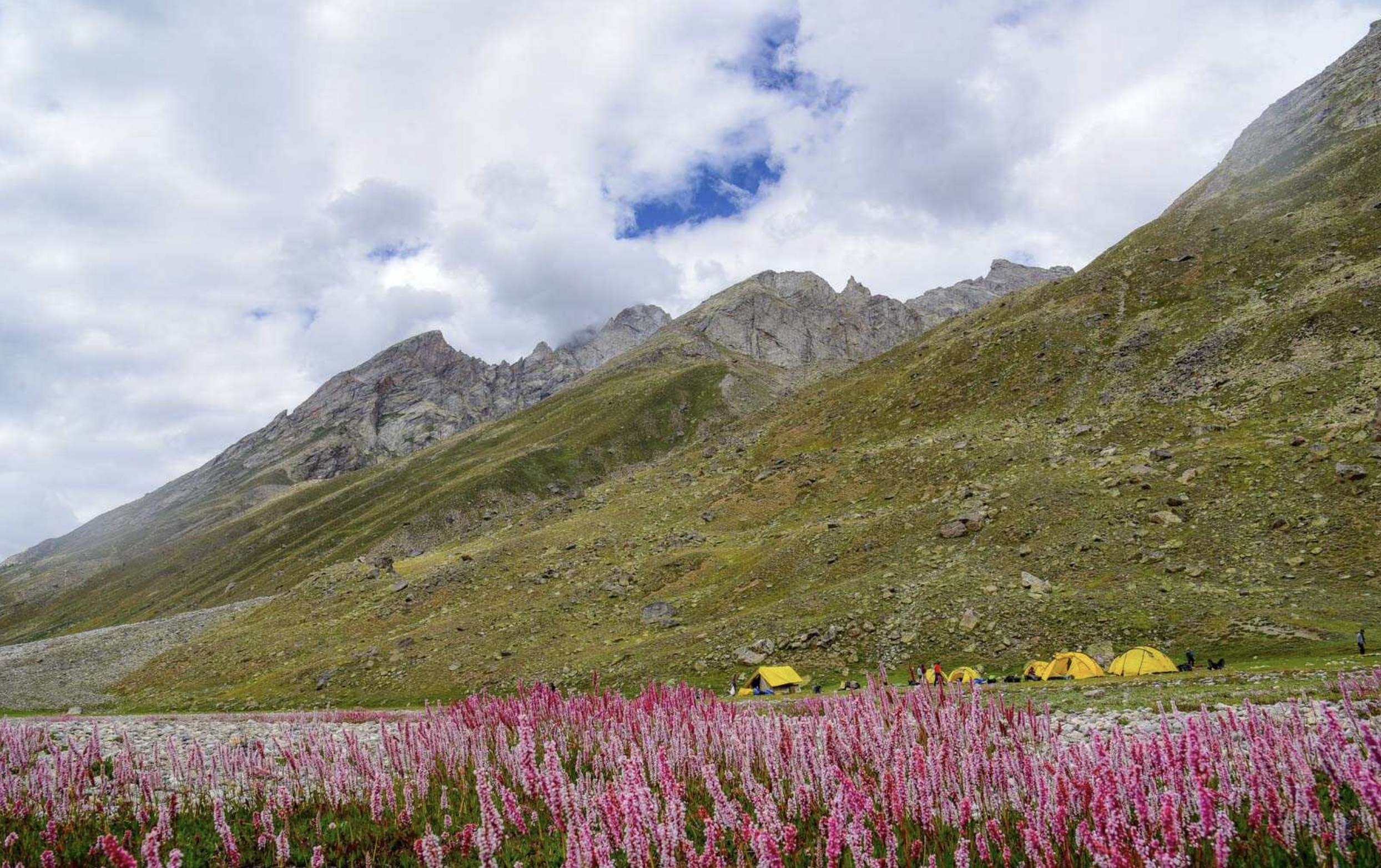
A trekking camp, during the flowering season, Miyar, India.

Performers of Spiti's traditional dance in traditional dresses posing during the Ladarcha fair. Photo by Nawang Changchuk.

The Lakshana Devi Temple in Bharmour is a post-Gupta-era Hindu temple in Himachal Pradesh dedicated to Durga. It is dated to the second half of the 7th century, and is one of the oldest surviving wooden temples. The Himachal Hindu community has preserved its intricately carved wooden entrance. The wooden carvings include Shaivism and Vaishanavism motifs and themes. Photo by Dhruvaeng.
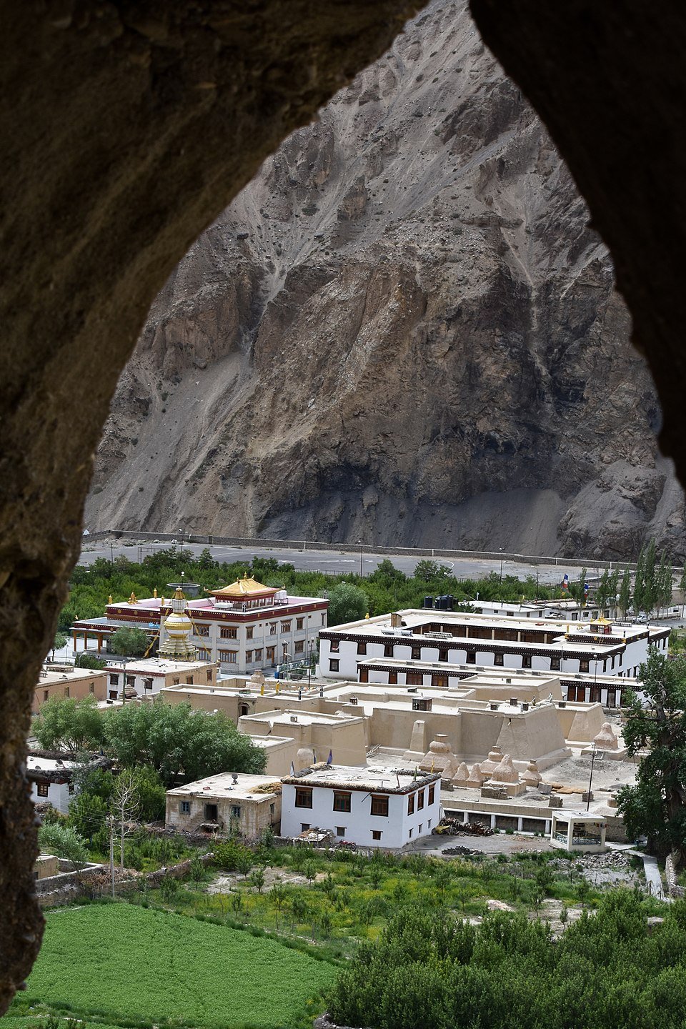
The Tabo Monastery viewed from monks' caves. Photo by Timothy A. Gonsalves.

Pseudois nayaur, Bharal, Himalayan blue sheep. The Bharal is known as the Himalayan blue sheep though strangely enough, it is neither blue nor is it a sheep.Blue Sheep occupy a variety of habitats across the region. They are very tolerant of environmental extremes from desert mountains in searing heat to windy and cold slopes (Schaller 1998). They are usually found near cliffs and similar escape cover, but avoid entering forested areas (Schaller,1977). Mass 35 to 75 kg; avg. 55 kg (77 to 165 lbs; avg. 121 lbs). Photograph by Reurinkjan.
Cultural and Ecological History
The name of the state of Himachal Pradesh is a reference to its setting. Himachal means "snowy slopes" in Sanskrit: hima, means "snow" and acala/achala meaning "slopes" or "land" or "abode." Pradesh means "state." Himachal Pradesh literally means "snow-laden province." Himachal refers to being in the "aanchal" of the Himalayas and sheltered by the Himalayas or by the snow. Overall, it means "the land in the lap of snowy Himalayas."
The word Himachal was added in the national anthem of India "Jan Gan Man" by Gurudev Rabindranath Tagore when he was writing and composing it. After the independence of India, Punjab province was divided and the name was given officially to the mountain state as Himachal Pradesh. Himachal is in the western Himalayas situated between 30°22′N and 33°12′N latitude and 75°47′E and 79°04′E longitude. Covering an area of 55,673 square kilometres (21,495 square miles), it is a mountainous state. The Zanskar range runs in the northeastern part of the state and the great Himalayan range run through the eastern and northern parts, while the Dhauladhar and the Pir Panjal ranges of the lesser Himalayas, and their valleys, form much of the core regions. The outer Himalayas, or the Shiwalik range, form southern and western Himachal Pradesh. At 6,816 meters, Reo Purgyil is the highest mountain peak in the state of Himachal Pradesh.
The Lahaul-Spiti region of the state, being a cold desert, supports unique plants of medicinal value including Ferula jaeschkeana, Hyoscyamus niger, Lancea tibetica, and Saussurea bracteata. Himachal is also said to be the fruit bowl of the country, with widespread orchards. Meadows and pastures are also seen clinging to steep slopes. After the winter season, the hillsides and orchards bloom with wild flowers, white gladiolas, carnations, marigolds, roses, chrysanthemums, tulips and lilies are carefully cultivated.
Miyar Valley, located in the Lahaul district of Himachal Pradesh, is a scenic, remote valley known for its stunning landscapes and trekking opportunities. It's a hidden gem, attracting adventure enthusiasts and nature lovers, and is also considered a "Valley of Flowers" due to its abundant Himalayan orchids. The valley is connected to Zanskar by an ancient trekking route over Kang La, offering a unique experience. The total area of the Spiti valley is 7,828.9 km2 (3,022.8 sq mi) and the total population in 2011 was 17,104 persons. Administratively, most of Spiti valley falls under Lahaul and Spiti district with a small part coming under Kinnaur district.

The Spiti River above Kaza, Lahaul and Spiti Dist, Himachal, India. The river bed is several hundred metres wide. The river itself is much narrower and meanders along the river bed. The elevation in this photography is 3,600 meters (11,811'). Photograph by Timothy A. Gonsalves.
Precipitation, Temperatures and Glaciers
The Miyar Valley is a remote and scenic valley located in the Western Himalayas. It is a part of the Lahaul Range, located between Pir Panjal and Zanskar Range. The valley is nearly 75 kilometers long and stretches between Udaipur (2649 m) and Kang La Pass (5468 m). More than 50% (568 km2) of area of the Miyar Valley is covered in glaciers. Kang La at the head of Miyar Valley is one of the extreme points of India. Administratively, the valley belongs to the district of Lahaul and Spiti (Himachal Pradesh). Temperatures and precipitation in the Miyar Valley vary widely. The annual average values are respectively: at the mouth of the valley – Udaipur (2649 m) 9.4 °C and 1057 mm; in its middle part – Sucto village (3448 m) 5 °C and 605 mm; and in higher parts (alpine and nival level) average annual temperature always stays below 0 °C.
According to Saini the soil cover of the Miyar Valley can be classified into three types: Himalayan Alluvial Soils (Group B), Mountain and Hill Soils, High Altitude Meadow Soil. The valley is inhabited by Tharanga people which are influenced by Tibetan Buddhism. Only a few hundred people live concentrated in 16 villages – among others, in Urgos (226), Tingrat (171), Ghumpa (45) Khanjar (48) and Sucto (37) – excluding Udayapur.
Inhabitants are engaged in mainly farming and pasturing. Due to the belief and influence of Tibetan Buddhism, the population is largely vegetarian and lacto-vegetarian. The economy of the valley is dominated by extensive farming. A short growing season (May–September) and low-quality soil limit agricultural production. Among the main food crops are peas, barley, buckwheat, seed potato. Kuth (Saussurea lappa) and mannu (Inula racemosa) are grown for medicinal use. Agriculture is accompanied by typical pastoral breeding (sheep, goats) and cattle breeding (cows, horses, donkeys). Miyar Valley is attractive to explorers and mountaineers for being one of the few remaining "white spaces" on the map. In 2012 Michal Apollo, Phil Varley and Marek Zoladek made the first summit of an unclimbed mountain, naming it Forgotten Peak.